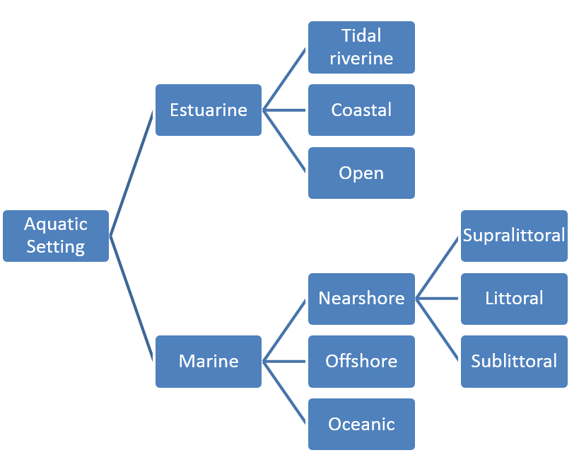
Aquatic setting provides a high level classification of the aquatic environment, freshwater influence and depth band of the habitats and biotopes of interest.
Hierarchy
CBiCS aquatic setting adopts the CMECS hierarchical structure:
Systems – there are three systems, which are based on salinity and general characteristics of the water body
Subsystems – describe depth and position relative to the shoreline
Tidal zones – describes the degree of inundation of shores
Class Descriptions
- Lucastrine
- Estuarine (tidally influenced waters regularly diluted by freshwater)
- Tidal riverine coastal (tidal freshwater < 0.5 PSU)
- Littoral
- Sub-littoral
- Tidal riverine open water (depth > 6 m)
- Sub-littoral
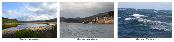
- Coastal (supratidal to 6 m depth, > 0.5 PSU)
- Supra-littoral
- Littoral
- Sub-littoral
- Open water (greater than 6 m depth, salinity typically 35 PSU)
- Sub-littoral
- Tidal riverine coastal (tidal freshwater < 0.5 PSU)
- Marine
- Nearshore (supratidal to 30 m depth)
- Supra-littoral
- Littoral
- Sub-littoral
- Offshore (30 m depth to shelf break)
- Sub-littoral
- Oceanic (shelf break to open ocean)
- Sub-littoral
- Nearshore (supratidal to 30 m depth)
Aquatic Hierarchy Explorer
The aquatic setting hierarchy can be explored by clicking here.
Key CBiCS Distinctions
CMECS defines estuaries as “waters with an open surface connection to the sea”. For CBiCS, the term estuary was modified to include coastal lagoons that can be closed from the sea for periods of time. This aligns CBiCS with estuarine environments found in temperate Australia and also aligns more closely to existing estuary mapping and classification (PDF, 17MB).
CMECS distinguishes between open water and coastal estuarine as a water depth greater than 4 m. For CBiCS, this limit was modified to 6 m depth to align with the international Ramsar wetland boundaries – a common mapping requirement.
For CBiCS, the 30 m depth contour is used to distinguish the nearshore marine subsystem from the offshore subsystem. It is recognised that this is somewhat arbitrary and it should be noted that the 30 m depth contour can occur in close proximity to shore. This depth contour is practically convenient and does approximate the coastal euphotic zone in temperate Australia, demarcating a transition from algae-dominated biotopes to sessile filter-feeder dominated biotopes. Further, this depth contour demarcation, especially when it occurs close to shore, can conveniently represent the energy regimes impinging on the subtidal habitat and the neighbouring intertidal and terrestrial habitats. For example, where a 30 m contour occurs in close proximity to shore, the shoreline environment will likely be exposed to high energy regimes and the neighbouring intertidal and terrestrial environment is likely to consist of cliff/bluff/boulder/platform geoforms. However, it should be noted that a depth contour alone does not directly relate to the differentiation of the infralittoral zone from the circalittoral zone in the biotic component. For the biotic component, CBiCS conforms to the EUNIS/JNCC categorisation of infralittoral and circalittoral zones which is based on the depth of the euphotic zone and thus community types. The depth of the boundary between infralittoral and circalittoral zones varies between locations and is often shallower or deeper than 30 m.
Definitions
CBiCS will update and maintain and update a dictionary of standard terminology used in each component.